發布日期:2008-04-01更新日期:2008-04-01
Biking in Kaohsiung City
The City of Kaohsiung has currently constructed 105 kilometers of bike path next to the mountain, along the river, and around the city. They will continue to extend the length of the bike path to 180 kilometers by 2009. Therefore, biking has become one of the most pleasant ways to explore the city.
Traveling by bicycle is one of the best ways to visit Kaohsiung City sites because there are mountains, sea, and rivers and the bike paths that are more than 100 kilometers in length (and the length is still increasing) connect these sceneries into a healthy and interesting recreational network.
West Side Harbor Line Bike Path
5.6 kilometers
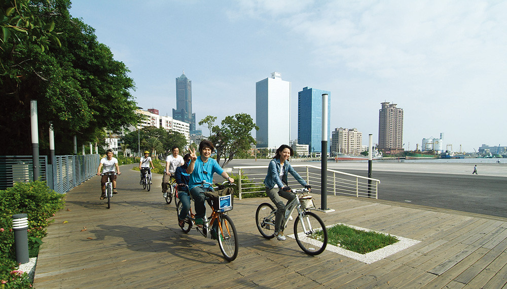
West Side Harbor Line Bike Path was adapted from an old railway line and is one of the best types of bike paths. The straight moving line, enough road width and the prior right of way make the path suitable for commuting and recreation. West Side Harbor Line Bike Path starts from Fisherman's Wharf and goes through the Pier-2 Art District and Love Pier to Glory Pier. Although the length is only 1.2 kilometers at present, the splendid view along the harbor and the great moving line still attract more people to join the cyclists' group. It will stretch to Singuang Rd. in the future and will connect Formosa Boulevard Bike Path and even Cianjhen River Bike Path and Cueihen Road Commuting Path. It will become the best bike path for commuting and recreation near the Port of Kaohsiung.
Comment by the Expert:
Even though West Side Harbor Line Bike Path and Love River Bike Path are linked together on the map, it's a pity that because of the difference of heights, the two paths can't be connected. If you want to go to Love River Bike Path through this path, it is suggested that you should take the sub-path to the parking lot on Gongyuan Rd. on the left before you go across Love River and then ride a short distance of Gongyuan Rd. to reach Love River Bike Path. This is the best way to go to the scenic spots along Love River.
Houjin Creek Bike Path
9.8 kilometers
Houjin Creek is the most northern river in Kaohsiung City. Its basin includes Nanzih District, Kaohsiung Metropolitan Park, National Kaohsiung Marine University, National University of Kaohsiung, Nanzih Industry Area, Houjin, Yuanjhonggang and more. The bike path along the river provides a bikeway for community residents to cycle for fun as well as for students and office personnel commuting. The completed bike path starts from Dehuei Bridge in the east and stretches west to Singjhong Water Gate, with two sides of the path along the riverbanks. The path goes north to connect to National University of Kaohsiung. In the near future, it will stretch east to Kaohsiung Metropolitan Park and Nanzih District and west to the estuary of Houjin Creek and Yuanjhonggang Wetland.
Comment by the Expert:
Houjin Creek Bike Path is more open and has fewer interruptions, making it an ideal sports bike path. In the future, as it connects Kaohsiung Metropolitan Park and Yuanjhonggang Wetland, the recreational function will be more complete and it will attract more visitors to cycle and appreciate the ecological environment.
Bike Path Connecting Love River and Lotus Pond
28 kilometers
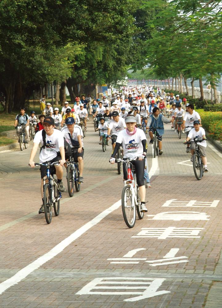
Love River Bike Path is the longest bike path system in Kaohsiung. It starts from the estuary of Love River southward and reaches one end of Tiansiang Rd. northward. It connects Smile Park, Sinjhuang Rd., Railway Green Belt and reaches Indigenous Plant Garden. Across Cueihua Rd., the bike path around Lotus Pond has its own system. The route is long and many scenic spots are along the path. Thus it is the representative sightseeing bike path in Kaohsiung. Visitors can travel from the pier to Heart of Love River, Tzu Chi Community and Riverbank Community...etc. Traditional scenic spots such as Old Fongshan City North Gate, Spring & Autumn Pagodas, Dragon Tiger Tower, Confucius Temple and the ideal eco-reviving Jhouzih Wetland Park are all around Lotus Pond. The outdoor coffee shops along Love River, characteristic restaurants in Riverbank Community, and the traditional snack diners in Old Zuoying City Wall area are the energy supply depots along the path.
Comment by the Expert:
There is no doubt that the path is colorful and full of diverse scenic spots. All you have to worry about is if your feet strength is good enough. If you set off from Love River, after you arrive at Old Zuoying City Wall, you may choose to take Gushan Rd. and go southward from the South Gate. Although the road is not a bike path, there are few cars and the scenery is beautiful. Also, the Chaishan Park along the road connects to Love River Bike Path and forms a wonderful round route.
Bo-Ai World Games Bike Path
9.8 kilometers
Bo-Ai Rd. starts from the rear of the train station and goes through New Civic Center and Kaohsiung Arena Shopping Area. It is the central artery of the new town in North Kaohsiung. This route is not only the Bo-Ai Landscape Roadway bike path but also the ground path for KMRT Red Line. It provides a more convenient and safer passing space for bicycles. The Heart of Love River midway is also the axis of the Love River bike paths and forms a convenient bike path network in North Kaohsiung.
Comment by the Expert:
Since the path goes through a noisy shopping area, many people and cars may often enter and exit along the bike path and many goods might be transported there. Therefore, pay careful attention to your speed. It would be better to ride on the Bo-Ai World Games Bike Path with a more leisurely mood.
Formosa Boulevard Bike Path
5.2 Kilometers
Formosa Boulevard is situated between Kaohsiung Train Station on Jhongshan Rd. and Singuang Rd. Since most of the busiest stations of KMRT Red Line are located in this area, the rearranged roadways were thus born. The sidewalks and bike paths are broad with many beautiful Chinese pistache (pistachio?) trees along the way. This is a new type of bike path that combines the functions of commuting and recreation in Kaohsiung. Formosa Boulevard connects the train station, Nanhua Shopping Area, Central Park, Shinkuchan Shopping Area, Sanduo Shopping District and the cross stations of KMRT Red and Orange Lines. This area is the essential business region in Kaohsiung. The bike path creates an atmosphere of peace in the midst of the noisy district. Outdoor coffee shops, green belt parks, and popular commodities can be found all over the area. You may travel around Kaohsiung with a whole new point of view.
Comment by the Expert:
It is pleasant to ride a bike on Formosa Boulevard because it presents an impression of a modern city and it's safe and comfortable to ride there. However, when entering the path at intersections, you should be careful of the traffic.
Cijin Oceanview Bike Path
15.5 kilometers
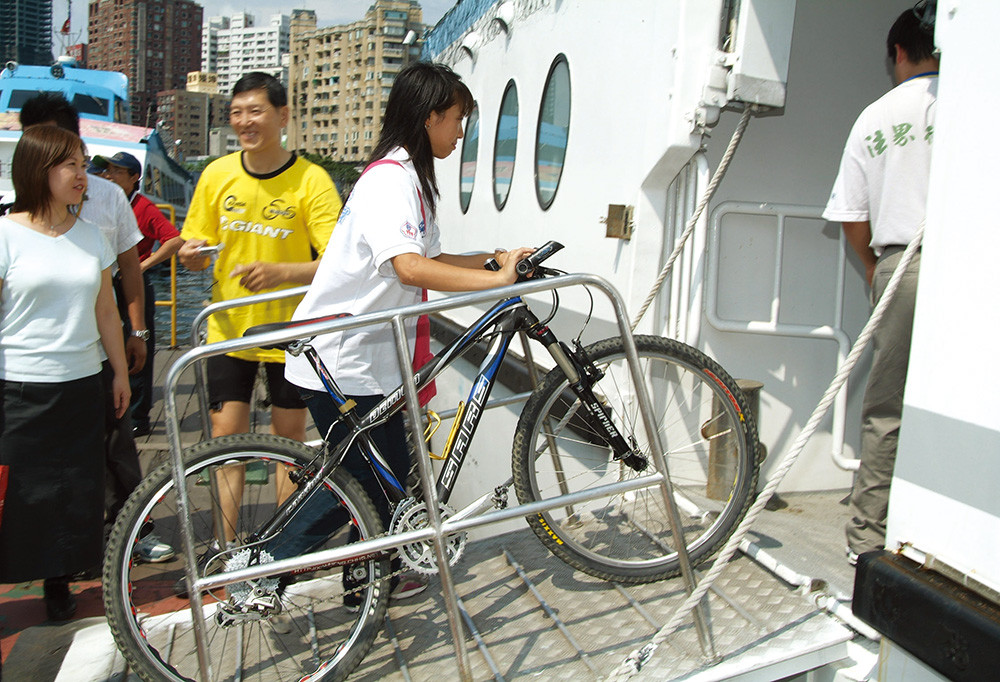
Cijin Oceanview Bike Path is divided into 5 loops with the loops connecting all the scenic spots on Cijin. Riding through Loop 1, you may visit Cihou Lighthouse, Cihou Fort, Tianhou Temple, Cihou Church, Cijin Tunnel of Stars, and the coral reef terrain. Loop 2 connects Cijin Beach, Cijin Seaside Park, Seafood Street, and a shipyard. Loop 3 connects 25 Ladies' Graveyard, 4X Cycling Velodrome and more. Loop 5 is good for exercising because you can ride from Oceanview Seawall all the way to Pier 2.
Comment by the Expert:
Since there are 5 loops, the moving lines are more complicated and thus you don't have to persist in planning traveling routes. You may start from Cijin Beach and ride along the Cijin Seaside Park to Pier No.2. You may also visit the fish market and the shipyard midway then go back to Tianhou Temple and Seafood Street close to the ferry wharf to enjoy the pleasant bike journey on Cijin.
Cianjhen River Bike Path
2.4 kilometers
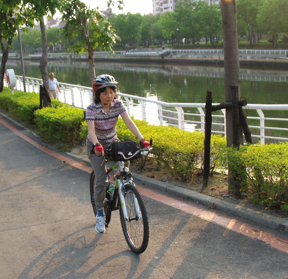
Cianjhen River Bike Path also provides construction access for the river dredging project. This path provides the bikeway between Cueihen Rd. and Cianjhen Ferry Wharf along Cianjhen River. The dredging project of Cianjhen River is one of the most important river dredging projects in Kaohsiung City. The environment along the riverbanks is clean and bright. This path is a communal recreational bike path.
Comment by the Expert:
The route of this path is simpler. You may ride the bike on Jhonghua 5th Rd. and Dream Mall Boulevard to increase the recreational spots.
鐵馬遊港都─7條自行車遊憩路線
◎文/阿桂 ◎攝影/鮑忠暉
騎鐵馬是高雄最佳的遊玩方式之一。因為高雄擁有山、海、河、港,長達105公里的自行車道,串連成健康又有趣的遊憩網路(2009年可達180公里)。
西臨港線暢遊行 5.6公里
由舊鐵道改建,高雄西臨港線是自行車道中最好的類型之一,平直的動線,足夠的路幅,以及優越的路權,非常適合作為通勤及休閒用途。西臨港線目前由漁人碼頭經駁2特區、真愛碼頭,到光榮碼頭雖然只有1.2公里,但是臨港壯闊的景觀、優越的動線吸引更多人加入單車一族的行列,未來延伸到新光園道,就可以和美麗島大道,甚至與前鎮河自行車道、翠亨路通勤車道接軌,變成高雄港邊最佳的單車通勤、休閒路線。
達人小評:
地圖上西臨港線雖然和愛河自行車道是接在一起的,可惜的是因為高度落差而無法互相接軌。若要由本線接愛河自行車道,建議在過愛河之前先循左側通往公園路停車場的支線下來,走一小段公園路再接回愛河自行車道,才可以過渡到愛河沿線景點。
後勁溪暢遊行 9.8公里
後勁溪是高雄市最北邊的河流,流域涵蓋楠梓、都會公園、高雄海洋科技大學、高雄大學、楠梓工業區、後勁、援中港等。沿著河岸的自行車道則是社區親子休閒騎乘,或學生、上班族通勤取道之用。目前完成的部份東起德惠橋,西到興中閘門,河岸兩側雙線,再往北接高雄大學。將來東邊會延伸到都會公園及楠梓市鎮,西邊則延續到後勁溪出海口、援中港濕地。
達人小評:
後勁溪自行車道較為空曠、少干擾,是不錯的運動休閒路線,將來連接都會公園及援中港濕地則遊憩功能更完備,將可吸引更多人來騎乘自行車與觀察生態之旅。
愛河連接蓮池潭 28公里
愛河自行車道是高雄最長的單車道系統,南起愛河口,北到天祥路口,接續微笑綠園道、新莊路、鐵道綠帶,一直到原生植物園;而隔著翠華路的連池潭環潭自行車道則自成一格。不僅路線長,沿途經過的景點眾多,是高雄代表性的觀光自行車道。遊河碼頭、愛河之心、慈濟園區、河堤社區...;還有連池潭周邊舊城北門、春秋閣、龍虎塔、孔廟等高雄傳統景點,以及生態復育典範的洲仔濕地。而愛河露天咖啡、河堤社區個性餐飲,以及左營舊城小吃,更是沿路的精力補給站。
達人小評:
本路線豐富多元毋庸置疑,只需擔心自己腳力足不足夠。若由愛河出發,到達左營舊城,回程可以選擇在南門走鼓山路往南,這條路雖不是自行車道,但車少風景美,路旁的柴山公園,接回愛河自行車道,形成非常棒的環狀路線。
博愛世運自行車道 9.8公里
博愛路從後火車站開始,經過新市政中心、高雄巨蛋商圈,是高雄北區新市鎮中心的幹線。本路線既是博愛路林蔭大道型自行車道,也是捷運紅線的地上園道,提供自行車更為便捷、安全的通行空間。中途的愛河之心也是愛河自行車道交會的軸心,形成北高雄便捷的單車路網。
達人小評:
因沿途經過繁榮的商業區,自行車道沿線常有進出人車及物件,車速不宜過快,以更閒適的心情來通行博愛世運大道。
美麗島大道自行車道 5.2公里
美麗島大道即是原中山路火車站到新光路段,因捷運紅線主要的車站都在這一段,重新配置路面而誕生。本路線有寬廣的人行與自行車道空間,又有美麗的黃連木行道樹夾蔭,是高雄第一條兼具通勤、遊憩功能的新型自行車道。美麗島大道串連火車站、南華商圈、中央公園、玉竹/新堀江商圈、三多商圈,以及捷運紅、橘線主要車站,是高雄商業精華區,而自行車道卻有鬧中取靜的趣味,露天咖啡、綠帶公園以及流行商品沿途不絕,以全新的角度來遊玩高雄。
達人小評:
在美麗島大道騎車是很愉悅的,具有進步城市的意象,安全又愜意。但是在進入十字路口車道中仍須注意行車安全。
旗津環島踩風暢遊行 15.5公里
旗津踩風自行車道分成五個環線,把旗津的景點都串在一起,環線一可以拜訪旗後燈塔、砲台、天后宮、旗後教會、星空隧道、珊瑚礁海岸;環線二可以串連旗津海水浴場、海岸公園、海產街和造船廠;環線三可以接二十五淑女墓、4X競賽場、望海丘;環線四則是旗津風車公園、下水道展示館到景觀海堤;環線五則偏運動風,可以從景觀海堤一路騎到第二港口。
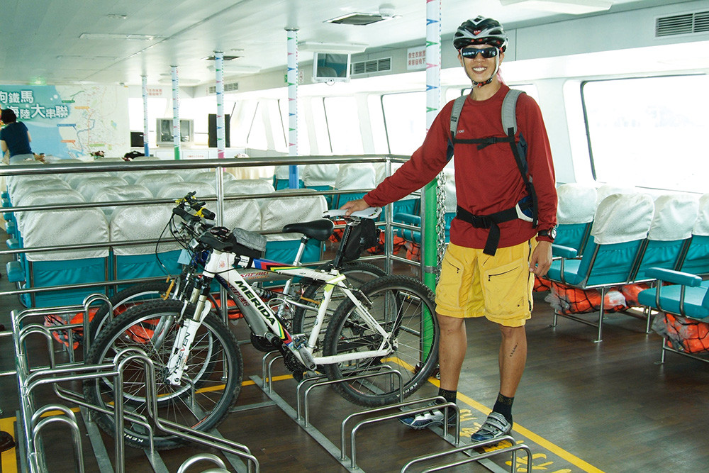
達人小評:
由於五段環線較為複雜,可以不必執著於規劃動線,從海水浴場開始,沿著海岸公園可由一路騎到第二港口,中途可造訪觀光漁市、造船廠,再回到輪渡站附近的天后宮、海產街等,盡興地享受一趟旗津單車之旅。
前鎮河自行車道 2.4公里
前鎮河自行車道也是屬於河川整治的附加建設,提供前鎮河沿線從翠亨路到前鎮輪渡站之間的單車通行動線。前鎮河整治也是高雄市重大的河川整治,沿途河岸空間整齊而明亮,屬於社區型的休閒單車道。
達人小評:
本路線較單純,建議可以連接中華五路及夢時代大道,增加一些單車里程及遊憩資源。