發布日期:2022-10-31更新日期:2022-10-31
Follow the Southern Cross-Island Highway into a Sea of Clouds
The Southern Cross-Island Highway, also known as the Nanheng Highway, reopened to the public this May following 13 years of repairs. One of three east-west highways constructed across Taiwan's Central Mountain Range, it chisels its way from Tainan City's Yujing District, through Liouguei and Jiasian districts in Kaohsiung, before following the upper reaches of the Laonong River. It ends in Haiduan Township in Taitung County.
The entire road can be driven in a single day, but it is better to arrange a two-day trip to fully experience the breathtaking mountain views along the highway.

Lavulang Community's Forest
Woodlands overseen by the Bunun indigenous people of Lavulang Community are an excellent option for those eager to avoid crowded tourist destinations. The best way to explore Mount Tieben's primary forest is to arrange a tour with Yisihtanda․Anu, a Bunun tribesman who runs a bed-and-breakfast in Taoyuan District. Long ago, Lavulang Community was located in the forest, which is around 1,600m above sea level.
The Isbukun people, a branch of the Bunun tribe, migrated southward from what is now Nantou County more than 200 years ago, settling in a number of locations, including Lavulang. To protect the forest's ecosystem, responsible management of the forest was returned to the community last year.
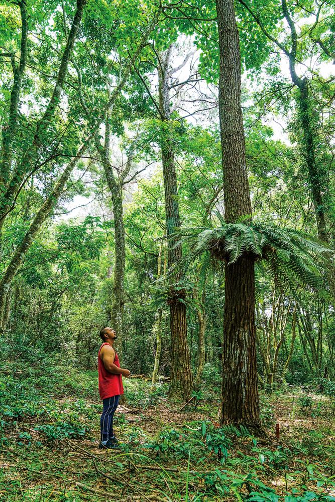
Even in midsummer, the forest offers cool temperatures. At the traditional prayer site (known in the Bunun Austronesian language as the Patvisan), native trees and plants — some of them more than 200 years old — thrive. Among them are Taiwan apple trees, maple trees, ring-cupped oaks, beech trees, litsea cubeba (mountain peppercorn, a food flavoring known to Mandarin speakers as magao, and called maqaw in some indigenous languages), and Mucuna macrocarpa.
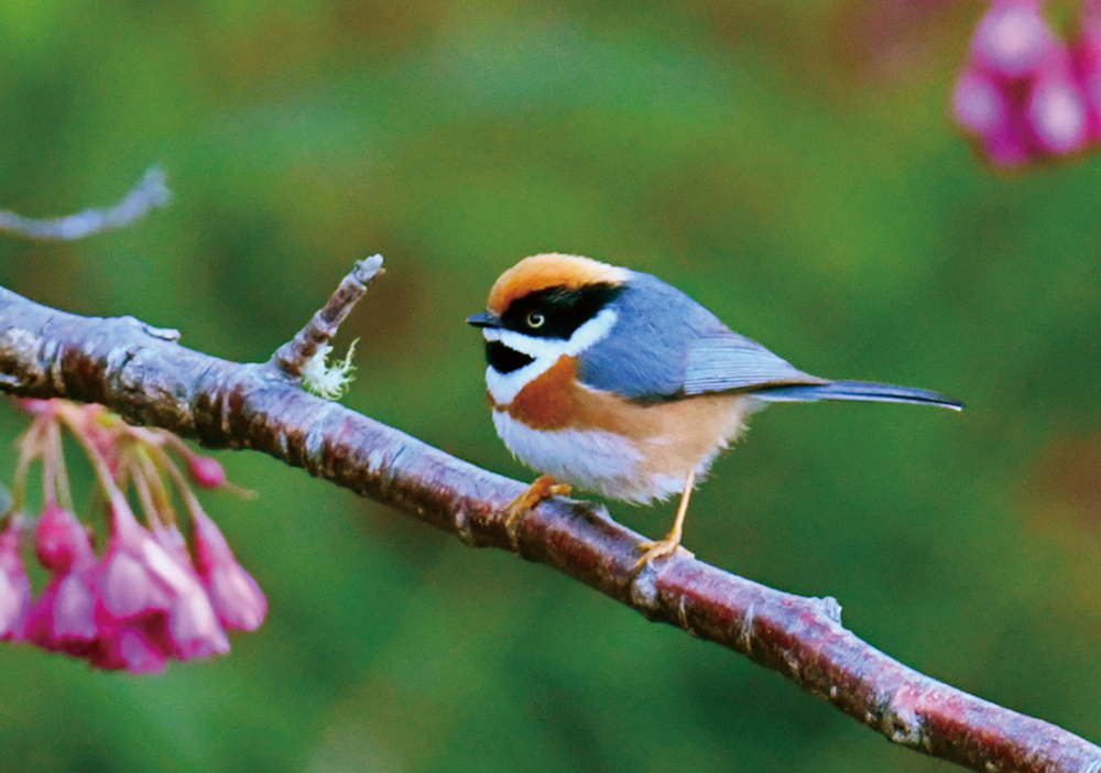
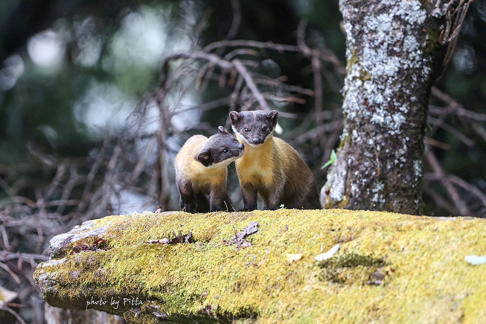
Bird enthusiasts might glimpse the Swinhoe's pheasant or the Taiwan blue magpie. The Reeves's muntjac — a small deer-like creature — is also seen hereabouts.
To make it easier for visitors to experience the Lavulang Community's forest culture, Anu's family repaired the ancient path their ancestors once used and created a park in the forest to allow tourists to experience arboreal culture. Visitors can enjoy Bunun-style meals while hearing clan lore at Lavulang Wooden House B&B.
After exploring the forest, visitors with enough time may want to drive to Meishan, one of the Southern Cross-Island Highway's busiest villages. The Bunun Cultural Exhibition Center close to Meishan Visitor Center is certainly worth visiting, a highlight being the replica slate house. Inside the center, visitors can learn about the Bunun people's migrations, as well as the tribe's legends, festivals, and traditional weaving.
Jhongjhihguan Old Trail
During the 1895-1945 period of Japanese colonial rule, the Japanese built the 171.06-kilometer-long Guanshanyueling Old Trail to better control the rebellious Bunun population around the Laonong River. The trail, which was completed in 1931, started from Liouguei in the west and ended in what is now Guanshan Township in Taitung County in the east. Today's Southern Cross-Island Highway follows a similar route to Guanshanyueling Old Trail. Among the few preserved segments of the colonial-era trail, the most intact is Jhongjhihguan Old Trail. This 3.6km-long route inside Yushan National Park is between 1,900 and 2,300 meters above sea level.
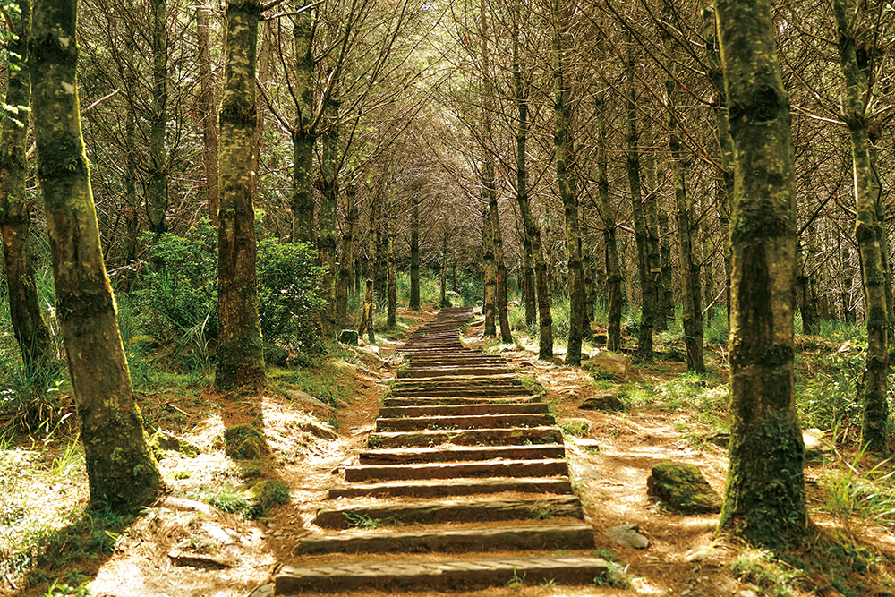
Tourists eager to visit Jhongjhihguan Old Trail are advised to start from the parking lot below Changcing Shrine (which honors the 116 workers who died constructing the Southern Cross-Island Highway) and follow the stairs next to the shrine. From the shrine, there are superb views over the surrounding mountains. It is not difficult to picture how difficult the building of the road must have been.
Walking along the boardwalk behind Changcing Shrine, it does not take long to reach a heart-shaped pond at an altitude of 2,280 meters. Taiwan red pines and spruces grow near the pond. Beyond the pond, the full coniferous forest comes into view. A forest fire some years ago has left behind a breathtaking yet forlorn forest landscape.
A half-circle around the pond connects you to Jhongjhihguan Old Trail. Along the way, you can see huge towering red cypresses and lush patches of woodland. Along the trail, it is possible to see the remains of charcoal kilns that date from the colonial era. These kilns supplied the nearby police station.
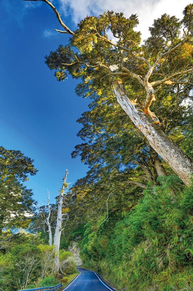
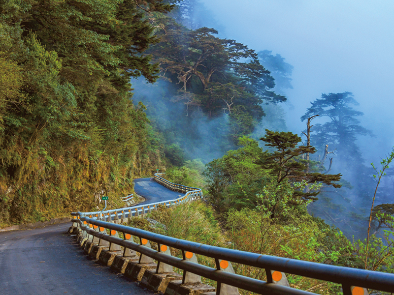
If visitors drive toward Taitung for approximately 5km, they will reach a section of road named Kuaigu (literally “Cypress Valley”). Here, towering cypress trees dwell within the forest fog belt. The afternoon clouds and mists make this a special spot for hikers, motorists, and all kinds of nature lovers.
• Meishan Visitor Center (Yushan National Park) 玉山國家公園-梅山遊客中心
Address: No. 44-5, Meishan Ln., Meishan Vil., Taoyuan Dist., Kaohsiung City
Phone: 07-686-6181
• Nanheng Lavulang Wooden House B&B 南橫.拉芙蘭木屋民宿
Address: No. 90, Sec. 5, Nanheng Highway, Lafulan Vil., 3rd Neighborhood, Taoyuan District, Kaohsiung City
Phone: 0978-541795
FB: Nanheng Lavulang Wooden House B&B (Chinese only)
南橫─雲海的故鄉
中斷13年的南部橫貫公路(南橫公路),終於在今年5月通車。南橫公路是台灣三條東西橫貫公路之一,從台南玉井到高雄甲仙、六龜,抵達南橫公路沿荖濃溪河谷兩岸,終點在臺東海端鄉。安排一趟南橫公路二日旅遊行程,走訪壯闊的大山景觀。
拉芙朗社氏族森林
避開趕集式的觀光人潮,跟著在高雄桃源區經營拉芙蘭木屋民宿的布農族人伊斯坦大・爾諾(Anu)先生走訪桃源區的鐵本山原始森林,海拔約1600公尺處的森林即是拉芙朗部落原址。
二百多年前,布農族郡社群從南投南遷,其中,拉芙朗社(布農族語Lavulang)定居於高雄桃源區的鐵本山脈。為永續保護原始林生態,此處林地前年回歸拉芙朗社氏族權責管理。
即使在盛夏,拉芙朗社氏族森林依然涼爽舒適,在氏族祈福場Patvisan栽植包括臺灣蘋果樹、楓樹、青剛櫟、櫸木、海木斯(馬告)、血藤等樹木及原生植物,幸運的話,還有機會巧遇藍腹鷴、臺灣藍雀或山羌。爾諾一家人恢復先祖走過的古道,還在森林設置一處園區,讓遊客體驗拉芙朗社的森林文化,拉芙蘭木屋民宿提供旅人在森林裡,享用布農族風味餐,聆聽拉芙朗社的故事。
從拉芙朗社氏族森林返回部落,時間尚有餘裕,不妨驅車前往南橫山區最熱鬧的梅山口,梅山遊客中心旁的布農文化展示中心值得造訪,館內搭建一座實體大小的石板屋,透過模型呈現布農族的遷徙足跡、編織、祭典、傳說故事等文化。
中之關古道
日本殖民時期,日方為了箝制荖濃溪流域的抵抗的布農族,興建全長171.06公里的關山越嶺道,1931年闢建完成,西起高雄的六龜,東止於今天台東縣的關山鎮。現今的南橫公路大致沿著舊關山越嶺道開設,迄今,在少數保留的古道路線之中,最具代表性的就是現今的中之關古道,中之關古道位於玉山國家公園境內,指天池至中之關這段長達3.6公里的路線,位於海拔1900公尺至2300公尺。
造訪「中之關古道」,建議遊客從「長青祠」下方停車處下車,循著「長青祠」階梯拾級而上,長青祠是用來紀念過往開闢南橫公路而殉職的工程人員,從長青祠前平臺,眺望群山環繞,不難想見闢路的艱辛。
從長青祠旁後方的木棧道行進,不久即抵達位於海拔2280公尺的天池,湖面呈心形的天池,池畔可見二葉松、雲杉等木本植物,過了天池一整片的針葉林,這裏曾發生森林大火,造就了蕭瑟美感的森林景觀。
繞行天池半圈可接上中之關古道,沿途林相優美。中之關古道靠近天池段可見巨大高聳的紅檜,蔥鬱林木,中之關古道還保留日本殖民時的木炭窯,木炭窯是早年日本殖民時代警察駐在所內柴火的最主要來源。
離開「長青祠」下方停車處繼續前行,朝台東方向行進約5公里 (距離天池本池和長青祠6公里處) 這一路段被稱為檜谷,從天池至檜谷沿途陸續會看見高聳巨大的檜木,這裏位於林霧帶,午後時常雲霧繚繞,是南橫健行的精華路段。
• 玉山國家公園-梅山遊客中心
地址:高雄市桃源區梅山里梅山巷44-5號
電話:07-6866181
• 南橫 • 拉芙蘭木屋民宿
地址:高雄市桃源區拉芙蘭里3鄰南橫公路五段90號
電話:0978-541795(預定民宿);0972-047101(預約鐵本山拉芙朗社氏族森林深度生態文化一日遊)
FB:南橫 • 拉芙蘭木屋民宿